Last year was the most significant year for commercial drones yet. More than 66,000 remote drone pilots were certified by the FAA in 2017 in the U.S. alone. Drones made their way into a diverse range of industries, from archaeology to construction, insurance to agriculture. Of course, millions of dollars have been invested in drone services, but Goldman Sachs estimates that the commercial drone market industry will surpass $20 billion by 2021.
One of the hottest drone products of the moment is the mapping service. DroneDeploy, a company founded in 2013, recently launched Live Map—the world’s first software able to generate drone maps in real time.
Usually, creating a drone map takes time—first you have to plan a mission, fly, capture imagery, go back to your desk to upload the data on your computer (it must be a suitably powerful computer) and then play the waiting game. For hours.
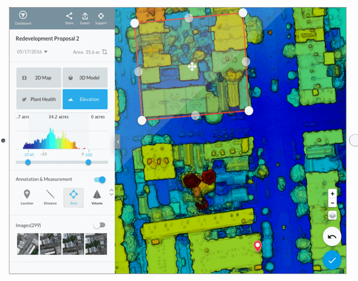
With the new service, those hours of waiting disappear—even without a laptop or even internet connection, you get the data you need immediately. The steps are simple: plan a flight, take off, look at maps render on-screen during flight. That’s it. Hundreds of acres of land can easily become consumable maps, shareable to collaborators via instant cloud-syncing across devices. Thus, if more in-depth analysis is required, users can also create higher-resolution 2D maps from the same flight data.
Live Map is the next-generation product of Fieldscanner, but it’s five times faster, which makes it capable of keeping up with the real-time challenges of the real world. “Hours of waiting for crop imagery are over. We can capture real-time data in seconds without an internet connection, and begin making smarter crop management decisions before the drone hits the ground,” says Justin Metz, technology integration specialist at Bowles Farms.
The leap was possible thanks to the advancement of technology: newer drones and mobile devices with robust communication links, precise GPS and improved computing capacity. And nowadays, the drone’s all-seeing eyes can help with monitoring tasks more easily and accurately.
In construction
DroneDeploy’s Live Map can really add a helping hand here—drone maps not only provide an aerial view of the project, but since each map includes a rich set of data, it can be used to measure and analyze pretty much anything on site:
- Monitoring: while it’s true that nothing beats a pair of boots on the ground, weekly (or with whatever regularity you desire) maps can make a big difference in the time you spend walking the entire site for inspection and monitoring. Via the drone map, whatever issue stands out and requires closer inspection, DroneDeploy’s built-in annotation tools give you the possibility to mark the exact location of the issue and make sharable notes for the most efficient follow up.
- Know of the issue faster: aerial imagery identifies conflicts that from ground level are practically invisible. The DroneDeploy interface allows you to overlay site plans or export your maps into industry software like BIM, GIS and CAD. Moreover, you can easily export your data in various formats including TIFF, KML, SHP, DXF, LAS, OBJ and XYZ, or use open APIs to sync your data with everyday tools.
- Because every location on a drone map is geotagged, you can make basic measurements almost instantly, from any device, from basic area and volume measurements to estimate stockpiles. In case you’re worrying about centimeter-level accuracy, ground control points (GCP) can be added to the map. These are the points that help the mapping software accurately position your map in relation with the real world.
- Reduce downtime by monitoring contracted work in real time: ever-more construction professionals use drone-generated measurements to review the work of site contractors. Having such a tool on hand, it’s much easier for a site manager to hold a contractor accountable and save downtime by making the needed requests before the contractor leaves the jobsite.
Applications for insurance
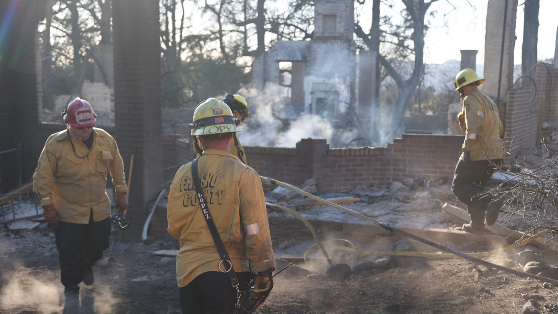
Last year was a difficult one primarily because of the unending list of natural calamities that seemed to follow some destructive choreography—hurricanes, floods, wildfires—they all came and went, taking with them precious lives and leaving behind damages that account to billions of dollars. DroneDeploy’s solution applies to the roofing industry as well as to solar and insurance companies as they can easily and affordably inspect and measure roofs with accuracy.
“Our customers—from leading solar, electric, and real estate enterprises to drone hobbyists who utilize DJI drones in their daily work — are experiencing incredible ROI with DroneDeploy’s Roofing solution,” says Jan Gasparic, head of enterprise partnerships, DJI. “When paired with our powerful aerial platforms, this new solution helps achieve greater time and costs savings, improved team efficiency, and accurate data collection. It’s truly redefining an industry where accuracy and safety are equally important—all with just the click of a button.”
Roofing companies are among those who benefit the most from the drone industry—in fact, they can triple the number of estimted and claims their teams can complete in one day, not to mention that the information is more accurate and the employees are subjected to no risks. The same data can be used by insurance companies, with faster results and more accurate claims processing.