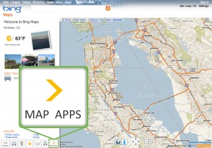
Bing is far from being one of the popular kids on the int ernet playground. But here’s some good news: Bing has updated Bing Maps with the option to view 35,000 live traffic cameras in 11 unnamed countries including the US and Spain. Pretty cool, no? This looks like a helpful tool in checking major roads for congestion before hitting the road. Moreover, the feature ties into the Clearflow traffic prediction algorithm which was launched in mid-November.
The move points to Bing Maps planning on becoming a strong competitor to Google Maps; Microsoft’s traffic service is well aware of the fact that it needs to offer what the competition doesn’t have if it wants to lure Google loyalists. However, Microsoft doesn’t want to force-feed the new service, thus those who are not interested in the camera feeds can toggle the feature off—this will hide the camera icons on the maps.
To access the traffic camera feature, users need to first download the Bing Maps app and then with a simple tap of the Traffic button (at the top of the app) they can study the traffic levels. Viewing multiple cameras at the same time is also possible, causing the screen to divide into smaller windows.
The user has the ability to configure a specific route, too. This way, the app will help peruse through the cameras that are on the path. Bing Maps separates traffic levels in four color-coded categories: green for no traffic, yellow for light traffic, orange for moderate traffic, and red for heavy traffic. Having access to this piece of information from the traffic cameras will make each and every driver plan a better, quicker route to their destination.
Furthermore, users can compare traffic cameras in the area by going to the Summary tab where they can see their recently viewed cameras. The cameras each user checks regularly for their daily commute are ready and waiting.
There is also one thing that Microsoft’s Bing Maps app does better than Google Maps: it highlights businesses between the start and end point on the itinerary, such as hotels, restaurants, or gas stations.
Microsoft developed an interface that is very intuitive and easy to begin using. I couldn’t help not wonder what downside the new feature will trigger—having this type of real-time information can be tempting for some that might want to use it with malicious intent and thus it makes me wonder: is the security risk worth it?
It’s clear that Microsoft wants the service to work. Throughout 2015 the company has been sprucing up its Maps via multiple feature additions: in July, Bing Maps suffered a major visual overhaul more similar to the likes of Google Maps, while last week the company added a new transit feature to make life easier for those who commute daily and rely on public transportation.


